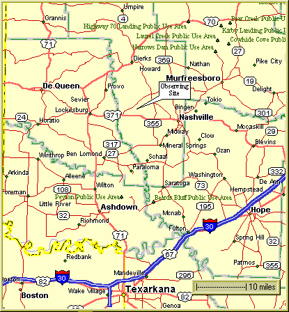
The first map shows the overall area from Texarkana to Umpire, and from DeQueen to Hope. The site is approximately midway between Lockesburg and Nashville, AR. It is about a one hour drive from Texarkana -- well worth it for the dark skies!
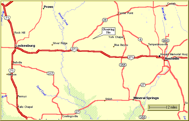
Next is a closer view of the area between Lockesburg and Nashville.
Finally, here's a detailed map of the roads you take to get from the main highways to the field. You can either take US 371 to Boatright Road, then take Boatright and Morris north to the field, or you can follow AR 26 to Anderson Road, then take Anderson and Morris south to the field.
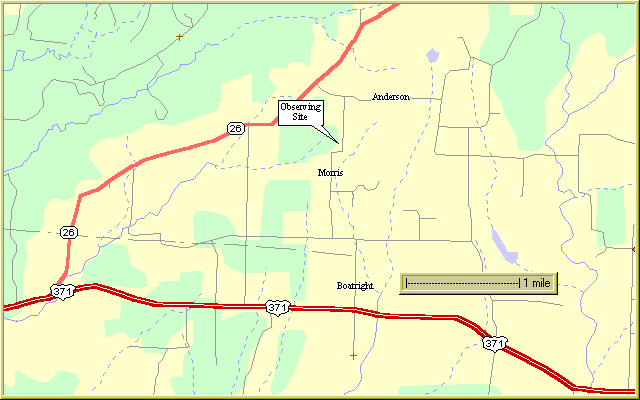
Turn left onto Hwy 26, and follow 26 northeast for 3.4 miles to Anderson Road.
Turn right onto Anderson, which is a gravel road. Go about a quarter mile, then turn right onto Morris Road, which is also gravel.
Go south on Morris for just under a half mile. Just before you get to a sharp 90 degree right turn, you'll be at the property, which will be on your right.
Turn left (north) onto Boatright Road, which is a gravel road. Go north a little over a half mile until you come to the tee. Take a left (west) and go about a quarter of a mile and then turn right (north) onto Morris Road.
Go about 3/4 mile north on Morris Road and you will come to a 90 degree turn to the right then another 90 degree turn to the left. Go about a hundred yards north after the second 90 degree turn, and the property will be on your left.
Turn right (north) onto Boatright Road, which is a gravel road. Go north a little over a half mile until you come to the tee. Take a left (west) and go about a quarter of a mile and then turn right (north) onto Morris Road.
Go about 3/4 mile north on Morris Road and you will come to a 90 degree turn to the right then another 90 degree turn to the left. Go about a hundred yards north after the second 90 degree turn, and the property will be on your left.
At Center Point turn right onto AR Hwy 26, then follow Hwy 26 4.6 miles southwest to Anderson Road. Turn left onto Anderson, which is a gravel road. Go about a quarter mile, then turn right onto Morris Road, which is also gravel.
Go south on Morris for just under a half mile. Just before you get to a sharp 90 degree right turn, you'll be at the property, which will be on your right.